


.avif)


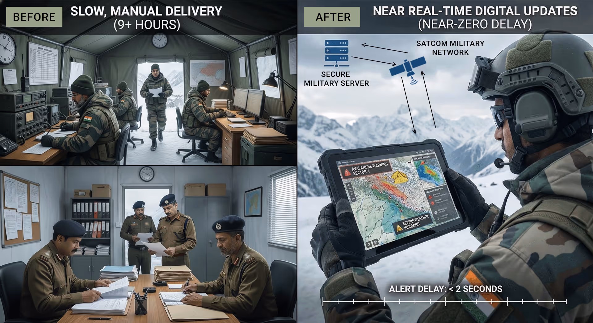


By unifying alerts, messaging, route support, and location sharing into a single interface, the platform improved how teams viewed and understood mission-critical information in real time. Scientists and field operators could see weather and avalanche alerts, terrain, routes, and device locations together, instead of relying on fragmented channels and manual coordination.
This clearer, consolidated view reduced delays, improved coordination between research teams and field units, and enabled faster, better-informed decisions in high-altitude, no-connectivity environments where timely awareness is critical for safety and operational readiness.
Integrate securely with DRDO networks and systems as a defense grade foundation
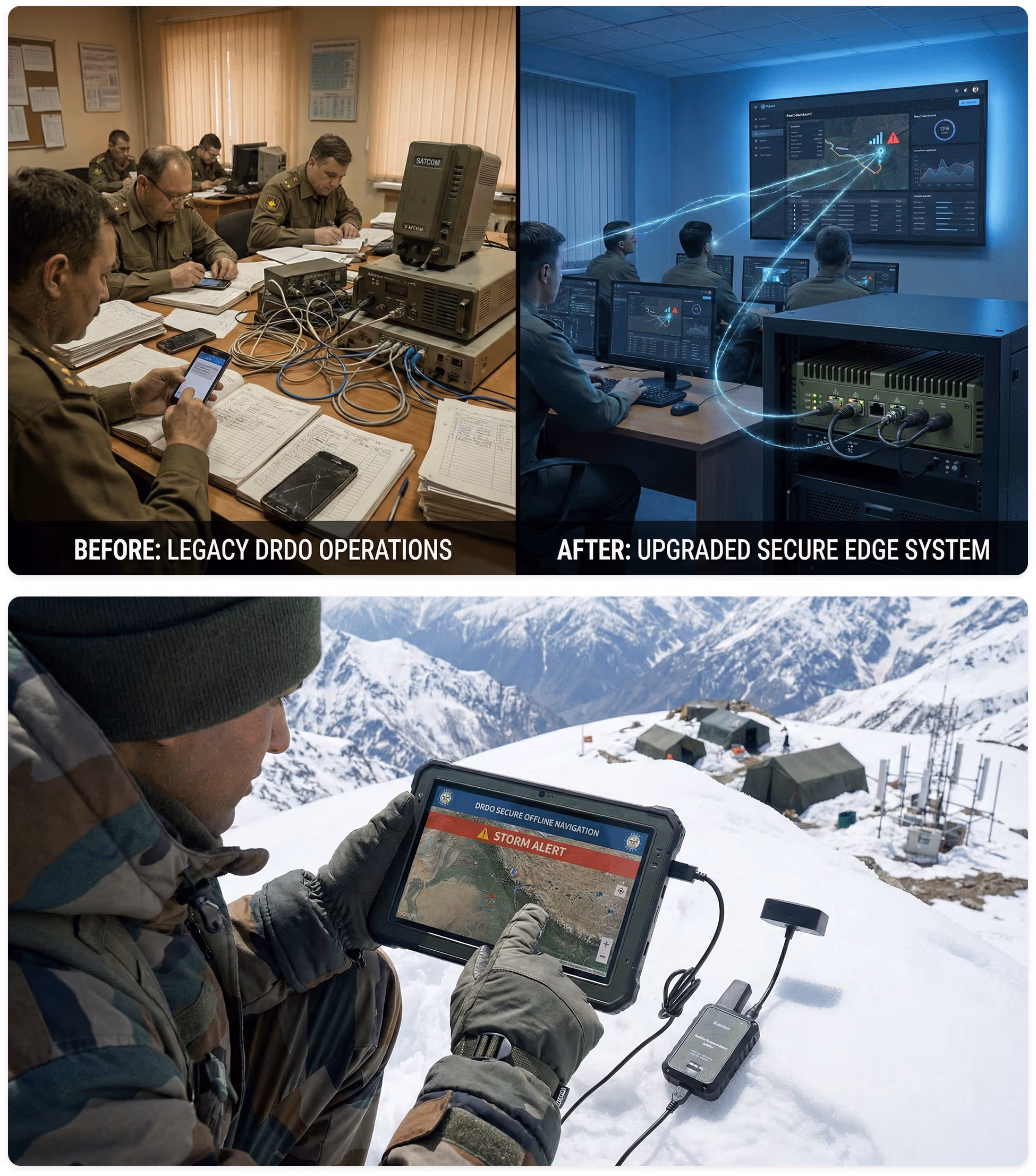
For DRDO, the first requirement was that any new system should fit cleanly into existing secure defense communication infrastructure, not create parallel workflows. During discovery, we studied how alerts, messaging, routes, and location updates were already flowing across existing protected systems and field communication channels. This helped us understand which parts of the current flow were manual, slow, or fragile. The goal was to respect existing security controls while quietly replacing the manual steps that caused long delays and errors.
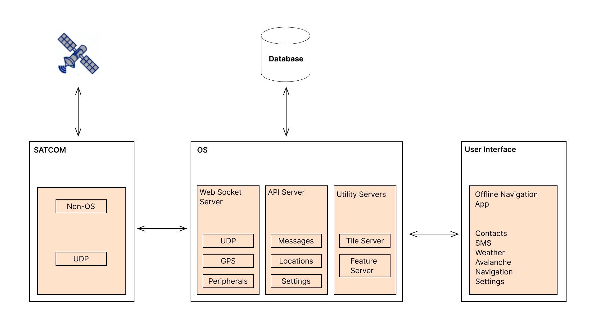
In the solution, a secure, offline communication backbone connected field devices with existing defense systems so alerts and mission data could move reliably across the protected environment without manual steps. The platform used custom backend services, an on-device data layer, and a secure frontend interface while remaining compatible with existing defense communication formats and field-ready embedded environments.


